
Wave Run-Up Forecast : North Shore, Oʻahu
This forecast is temporarily not updating. Please check back later for new data.
Attention: The forecast is not accurate when a tsunami, tropical storm or cyclone watch/warning is in effect. For these events, please seek information for either tsunamis or tropical storms/hurricanes. In case of a possible inundation event, please consult with local authorities and emergency responders to seek further information and direction.

The Solid Dark Blue Curve and Solid Cyan Curve display the Observed and Forecast Sea Level near Haleiwa Harbor for the previous 3 days and the next 6 days, respectively, relative to Mean Lower Low Water (MLLW, a typical NOAA datum).
The Dotted Dark Blue Curve shows the estimated maximum height reached by waves along the shore at Rock Piles (northeast of Waimea Bay) for the previous 3 days, relative to MLLW. The Dotted Cyan Curve shows the forecast height for the highest waves along the shore at Rock Piles for the next 6 days, relative to MLLW.
If the forecast exceeds 10 feet it is likely that there will be periodic overtopping of the roadways nearby. If the forecast exceeds 8 feet, overtopping of lower roadways closer to the shore (such as at Laniakea Beach and Dillingham Airfield) has been observed. One or more of the following threshold levels is/are shown in the red shaded area in the plot above: (a) Light Impacts, (b) Hazardous Impacts, (c) Critical Impacts. Click on the Examples tab for descriptions of the possible hazards.
The PacIOOS Wave Run-Up Forecast is a tool to predict the potential occurrence of high sea levels and wave inundation impacting the shorelines of Oʻahuʻs North Shore. Storm events, high waves, extreme tides, or a combination of these factors can lead to potential inundation.
The tool was developed to increase community resilience and enhance preparedness by providing decision-makers, agency representatives, and community members with time to plan in advance of potential flooding events. The forecast is updated hourly (about 15 minutes after the hour) and dates and times are shown in local time.
The PacIOOS Wave Run-Up Forecast does not serve as a warning system. In case of a possible inundation event, please consult with local authorities and emergency responders to seek further information and direction. A similar forecast is also available for Waikīkī.
Contact
For more information, please contact Assaf Azouri. The Wave Run-Up Forecast Tool was developed by M. Guiles, D. Luther, and M. Merrifield within the Department of Oceanography in the School of Ocean and Earth Science and Technology (SOEST) at the University of Hawaiʻi at Mānoa.
Run-up Thresholds
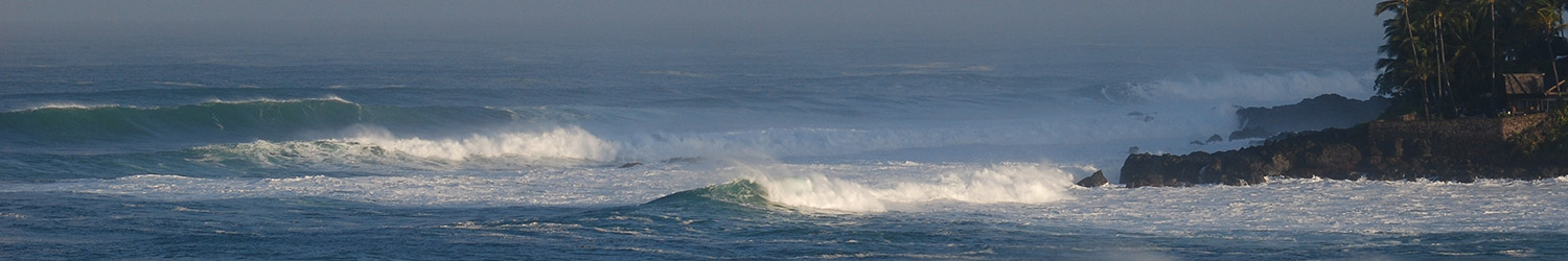
Depending on incoming swell direction the impacts can vary from Dillingham up to Turtle Bay. The threshold definitions have been formulated for the region based on analysis and modeling at Rock Piles Beach specifically. Wherever possible examples of the different impact levels will be provided from other locations.
(a) Light Impact – beach activities disrupted as occasional waves may sweep the beach slopes or intermittently reach vegetation or shoreline hardening structures in multiple locations.
(b) Hazardous Impact – heavy wave action on beaches; likely run-up to the vegetation and onto the parts of the coast that are not artificially hardened or shoreline hardening structures; battering of shoreline hardening structures backing some beaches; occasional overtopping of shoreline hardening and roads; and/or possible erosion of vegetation, dunes, or bluffs in vulnerable locations.
(c) Critical Impact – strong wave battering of vegetation, dunes or bluffs; strong battering of artificial shoreline hardening structures; strong battering and flooding of adjacent low-lying roads and land; regular overtopping of artificial shoreline hardening; likely flooding of adjacent land behind sand dunes and/or significant erosion of exposed volcanic sediment in multiple locations. Potential road closures and structural damage.
Run-up Examples
(a) Light Impact Event — January, 2012

Photo Credit: Martin Guiles.

(a) Light Impact Event — November 15, 2016

Photo Credit: Unknown.

(b) Hazardous Impact Event — February 10, 2016

Photo Credit: Steven Businger.

Photo Credit: Steven Businger.

(b) Hazardous Impact Event — November 26, 2018

Photo Credit: Alex Gibbs (orange star on map).

Photo Credit: Jodi Wilmott (orange star on map).

Photo Credit: Jodi Wilmott (orange star on map).

Photo Credit: Jodi Wilmott (orange star on map).

Photo Credit: Jodi Wilmott (teal star on map).

(b) Hazardous Impact Event — January 16, 2021

Photo Credit: Hawaii News Now (orange star on map).

Photo Credit: Assaf Azouri (orange star on map).

Photo Credit: Assaf Azouri (orange star on map).

Photo Credit: Assaf Azouri (orange star on map).

Photo Credit: Assaf Azouri (yellow star on map).

(c) Critical Impact Event — January 22, 2014

Photo Credit: Twtelecom (dark green star on map).

Photo Credit: John Bilderback (dark green star on map).

Photo Credit: Jose and Lisa Mejia (orange star on map).

Photo Credit: J. Schneider (yellow star on map).

Photo Credit: Doug Luther (yellow star on map).
.
Photo Credit: Pat Caldwell (purple star on map).

(c) Critical Impact Event — February 22, 2016

Photo Credit: Surfline (orange star on map).

Photo Credit: Surfline (dark blue star on map).

Photo Credit: Surfline (dark blue star on map).

Description of North Shore, Oʻahu, Wave Run-Up Forecast

The Solid Dark Blue Curve and Solid Cyan Curve display the Observed and Forecast Sea Level near Haleiwa Harbor for the previous 3 days and the next 6 days, respectively, relative to Mean Lower Low Water (MLLW, a typical NOAA datum). The sea level is calculated from tidal constituents derived from 2 years of data (January 2001 to December 2002) at Haleiwa Harbor. This tidal sea level variation and forecast captures most of the slowly changing sea level (without taking short period wind and swell waves into consideration) within 5-8 miles of Haleiwa Harbor. The forecast is updated every 4 hours.
The Dotted Dark Blue Curve shows the estimated maximum height reached by waves along the shore at Rock Piles (northeast of Waimea Bay) for the previous 3 days, relative to MLLW. The Dotted Cyan Curve shows the forecast height for the highest waves along the shore at Rock Piles for the next 6 days, relative to MLLW. These heights are equal to the Observed/Forecast Sea Level plus the Estimated/Forecast Wave Run-Up Height described below (estimated Black Dots; forecast Gray Dots).
If the forecast exceeds 10 feet it is likely that there will be periodic overtopping of the roadways nearby. If the forecast exceeds 8 feet, overtopping of lower roadways closer to the shore (such as at Laniakea Beach and Dillingham Airfield) has been observed.
Components of North Shore, Oʻahu, Wave Run-Up Forecast

The Black Dots display the Estimated Wave Run-Up Height for the previous 3 days, measured relative to the Observed Sea Level described above. The Wave Run-Up Height is a simple, empirically-determined function of the three quantities plotted in the bottom plot and described below. All three quantities are estimated from the observed sea and swell Off-Shore Gravity Wave Height, shown as the Dark Violet Line in the above plot (note that the mean value of all—estimated plus forecast—gravity wave heights has been subtracted from the wave height variables in this plot to simplify the plot). Forecast and observed gravity wave height (denoted Hs) is the mean of the largest 1/3 waves recorded during the sample period.
The Gray Dots display the Forecast Wave Run-Up Height for the next 6 days, relative to the Forecast Sea Level described above. The Forecast Wave Run-Up Height is a simple, empirically-determined function of the three forecast quantities plotted in the bottom plot and described below. All three quantities are forecast from the sea and swell Forecast Off-Shore Gravity Wave Height, shown as the Light Violet Line in the above plot (note that the mean value of all—estimated plus forecast—gravity wave heights has been subtracted from the wave height variables in this plot to simplify the plot).

This plot displays estimates and forecasts of the three quantities that determine the Estimated and Forecast Wave Run-Up Heights shown in the previous plot. The estimated quantities are based on empirical formulas applied to the observed Off-Shore Gravity Wave Height for the previous 3 days, while the forecast quantities are based on these same formulas applied to the Forecast Off-Shore Gravity Wave Height for the next 6 days.
Dark Red (Pink) Dots – Estimated (forecast) sea level “set-up,” which we will call SU.
Dark Orange (Light Orange) Dots – Estimated (forecast) maximum short-period (2-30 seconds) gravity wave swash height, which we will call SGW.
Dark Green (Light Green) Dots – Estimated (forecast) long-period (2-20 minute) gravity wave height, which we will call LGW.
Given these quantities, the estimated and forecast wave run-up heights are calculated as follows.
Estimated Wave Run-Up Height equals
1.2 x ( SU + 0.5 x sqrt( LGW^2 + SGW^2 ) )
Forecast Wave Run-Up Height equals
1.2 x ( SU + 0.5 x sqrt( LGW^2 + SGW^2 ) )
An archive of previous forecast plots can be accessed below. Select a day of interest from the calendar, or use the slider tool to quickly navigate through all available images. Two historical forecast plots are provided for each day, generated at 6:00 AM and 6:00 PM of the local time zone. To view the most recent forecast and to learn more about the different components of the graph, please go to the Forecast tab.
date: :
Loading archive...


