Modeling

Four modeling systems produce a comprehensive ocean state prediction for the main Hawaiian Islands. Recently, PacIOOS expanded our wave forecasting capability to Guam and the Northern Mariana Islands. To further expand services, PacIOOS has commissioned the construction and operation of high-resolution ocean and atmospheric circulation models for Guam, the Northern Mariana Islands, and American Samoa as well as the construction of a high-resolution wave model for American Samoa. These models will join the existing suite of operational PacIOOS models and are targeted for release in summer 2013.
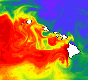
Circulation Modeling: Ocean circulation and current forecasts are made daily using the Regional Ocean Modeling System (ROMS) for the Main Hawaiian Islands with increased resolution on Oahu. Global coverage is provided by the HYbrid Coordinate Ocean Model (HYCOM).
Wave Modeling: Ocean waves are forecast daily using WaveWatch III (WWIII) and Simulating Waves Nearshore (SWAN) models with domains that extend throughout the entire Pacific with increasing resolution to each of the main Hawaiian Islands, the Mariana Islands, and the Samoan Islands.
Tide Modeling: Tide forecasts are produced separately for the Hawai‘i Island and the remaining main Hawaiian islands.
Atmospheric Modeling: The Weather Research and Forecasting (WRF) model produces daily atmospheric forecasts covering all of the Hawaiian islands as well as detailed forecasts for each of the main Hawaiian Islands. Global coverage is provided by NOAA/NCEP's Global Forecasting System (GFS).


