PacIOOS Ala Wai Turbidity Plume Model O‘ahu, Hawai‘i
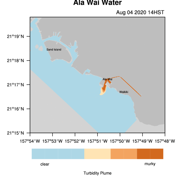
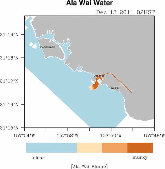
Turbidity Plume Model The plume position and turbidity values are determined using the results from the ROMS Ocean Circulation Model configured for the south shore of O‘ahu. The model simulates the plume advection and dispersion using near real-time river runoff and turbidity measurements for the Ala Wai canal, along with waves (SWAN) and atmospheric (WRF) model forcings. The results could indicate the fate of large discharges from the Ala Wai due to heavy rains or other events and the generation of a coastal "brown water" plume. It is important to emphasize that the plume position and turbidity values are predictions and --- like a weather forecast --- contain uncertainties.
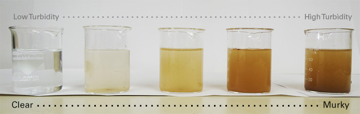
Turbidity and Water Quality (Note: Please refer to sensor data records for actual turbidity values) Turbidity is a measure of water clarity. Tiny solids suspended in the water column can increase turbidity levels. After a significant storm event "brown water" runoff from the land can raise turbidity levels in coastal waters. "Brown water" or storm water runoff can contain pollutants and contaminants, including sewage, harmful micro-organisms and chemicals from residential, commercial and recreational sources. Please visit the State of Hawai‘i Department of Health Clean Water Branch for more information on storm water runoff.
Turbidity Plume Model Example (Note: The example is an extreme event that typically occurs every few years.) The animation below serves as an example of a high rainfall event in December 2011, resulting in a large turbidity plume off the coast of Waikiki. The movement and lifespan of the turbidity plume through time depends on oceanic and atmospheric conditions. Examples of a few mechanisms that can affect the turbidity plume are: tidal currents, freshwater outflow as well as wind speed and direction.